Through My Eyes
*
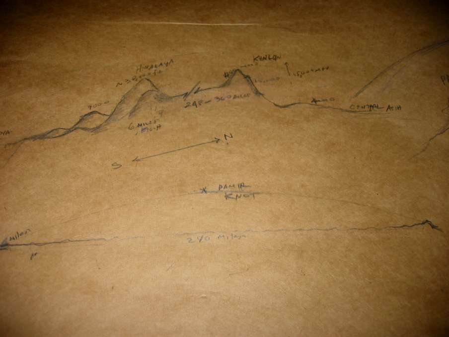
Here's we've made a bit more progress.The upper drawing is a cross section of Tibet to show the height of the mountains relative to the plateau. It starts in the foothills of India then rises up through two outer ranges of the Himalayas which are several thousand feet high. Then comes the great Himalayas where nine of the fourteen highest mountains of the world can be found! The mountain I've drawn is an approximation to Jomolangma or Mt.Everest, about 30,000 feet. I think the plateau is then at 15,000 feet or so rather than being at the base of the mountain on the inside. I'm not yet sure of this! At the Northern end would be the Kunluns which are only between four and five thousand feet high and blend in with the landscape. On the side that overlooks central Asia it's a completely different story! They tower 15,000 feet, almost 3 miles above the Tarim basin in central Asia!
The lower drawing shows the height of the mountains relative to the width of Tibet. Even Jomolangma is just a small blip compared to the overall expanse of the plateau itself which may make sculpting a bit difficult. I put a note about the Pamir knot as this is where the two great sets of ranges that surround Tibet meet in the west.

* courtesy of A Luminous Diamond (Bright) Crystal Show productions. The information for
the sketches is courtesy of the Footprint Tibet handbook by Gyurme Dorje.
 ( please click here to return to my spinning for you!)